
Commons:Graphic Lab/Map workshop
| Illustration Workshop | Map Workshop | Photography Workshop | Video and Sound Workshop |
 Map workshop
This workshop is part of the Graphics Lab, a project aimed at picture retouching to improve the graphical content of the Wikimedia projects. More information about the lab can be found on its main page and requests pages (Illustrations ; Photographs ; Maps ; Video and Sound). To ask questions or make a suggestions, see the talk page of the graphic lab page.
This specific page is the requests page for the Map Workshop. Anyone can make a request for a map to be created or improved. The standard format for making a request is shown below, along with general advice, and should be followed.
Make a request
Use the following template when making a new request, replacing the examples with your image(s) and request(s):
<gallery>
 IMAGENAME.EXT|Description of image
 IMAGE#TWO.EXT|2nd image (If there is one)
 ETCETCETC.EXT|Don't request too many at once, though
</gallery>

;Request:
: Details of your request go here… --~~~~
;Graphist opinion(s):
See also
[edit]| SpBot archives all sections tagged with {{Section resolved|1=~~~~}} after 7 days and sections whose most recent comment is older than 185 days. For the archive overview, see /Archive. The latest archive is located at /Archive/2025. | |
Russia Map Border
[edit]-
 Moscow boundaries need to be updated, they are outdated.

Article(s): Jewish Autonomous Oblast
- Request
- Moscow's boundaries need to be updated, they are outdated. --– Illegitimate Barrister (talk • contribs), 21:37, 4 August 2024 (UTC)
- Graphist opinion(s)
- Given this is likely an issue across all theoretically current Russian administrative border maps, it might be best to create a category to put maps needing an update in. CMD (talk) 13:59, 9 December 2024 (UTC)
Fehmarnbelt
[edit]-
(c) Bing
Article(s): de:Fehmarnbelttunnel
- Request
- Can we please convert this into a free license? Thanks --Bigbossfarin (talk) 06:13, 3 September 2024 (UTC)
- This may be possible by modifying File:Fehmarnbeltbrücke.svg. CMD (talk) 16:23, 4 September 2024 (UTC)
- Graphist opinion(s)
EU trading partners map
[edit]-
 EU trading partners map

Article(s): en:List of the largest trading partners of the European Union
- Request
- Can the map be edited to change the colour of the UK to the same as the USA as the UK is no longer a part of the EU please? --The C of E (talk) 17:47, 17 September 2024 (UTC)
- Graphist opinion(s)
- @The C of E: This map reflects data at 2015 when the United Kingdom was then a part of the European Union. J. Dann (talk) 13:22, 29 September 2024 (UTC)
Vectorize raster map file
[edit]-
 Raster logo file
Article(s): Heartland Flyer
- Request
- Hi! Please vectorize this raster map file. Thank you! --OrdinaryScarlett (talk) 09:02, 2 October 2024 (UTC)
- Graphist opinion(s)
Iraq Kurdistan political map
[edit]Article(s): Iraqi Kurdistan
- Request
- (Can anyone create a version of this map? Taken from this article. Ideally, we would have an English, Arabic and Kurdish version also. --الدبوني (talk) 07:17, 26 November 2024 (UTC)
- Graphist opinion(s)
- الدبوني: We have File:Kurdistan governorates 2015.png/File:Kurdistan governorates 2015-ar.png. Those will probably work well with appropriate captions. (The border of the east two governates is different but that doesn't affect the use at hand.) CMD (talk) 09:36, 29 November 2024 (UTC)
- @الدبوني and Chipmunkdavis: Hi,
- Displaying the map, if you click on Datawrapper under the map, you get a new display. Then this new map is composed thanks to an embedded svg. Copying/pasting this code will directly give a svg file (with probably some workaround).
- Copyright from OpenStreetMap contributors give a license compatible with uploading to Commons (to be confirmed).
- Yours, En rouge (talk) 14:09, 30 November 2024 (UTC)
- @الدبوني: Hi,
- Don't you think it will be better to start your page before any graphist works on your editing request?
- En rouge (talk) 15:15, 30 November 2024 (UTC)
Correct Green Valley, IL map to put circular emphasis on right municipality
[edit]-
 Highlighting is on wrong village

Article(s): en:Green Valley, Illinois
- Request
- The red circle is on the wrong village. It needs to be moved over to where Green Valley actually is (towards the bottom left). Thanks! --WhisperToMe (talk) 18:55, 1 December 2024 (UTC)
- Graphist opinion(s)
- WhisperToMe The 02:49, 28 October 2017 version seems to have the circle in the right place, but there is a square that changes color. Which square color is correct? CMD (talk) 00:24, 2 December 2024 (UTC)
- @Chipmunkdavis: The red settlement (the others are gray) is the correct location. The map is supposed to depict Green Valley, seen here. Compare with Tazewell County here. The circle is instead over Armington (which is depicted here: File:Tazewell_County_Illinois_Incorporated_and_Unincorporated_areas_Armington_Highlighted.svg). The circle is supposed to emphasize Green Valley. WhisperToMe (talk) 01:05, 2 December 2024 (UTC)
- That does seem to suggest the 02:49, 28 October 2017 has the correct circle, but do you know what to do with the square? ie. can this be reverted, or does a new version have to combine the old circle and new square? CMD (talk) 01:08, 2 December 2024 (UTC)
- @Chipmunkdavis: I see. The square should be en:Heritage Lake, Illinois (a census-designated place) based on the placement. I'm not really sure why it is not filled in with gray. I checked File:Harris County Texas incorporated and unincorporated areas Cloverleaf highlighted.svg and I notice some census-designated places are filled in with grey but some are not. Maybe I should ping the uploader and ask them if CDPs are supposed to be gray or white. WhisperToMe (talk) 01:59, 2 December 2024 (UTC)
- If it is, just revert to 02:49, 28 October 2017. If not, should be easy enough to combine the two.
- CMD (talk) 02:09, 2 December 2024 (UTC)
- @Chipmunkdavis: I see. The square should be en:Heritage Lake, Illinois (a census-designated place) based on the placement. I'm not really sure why it is not filled in with gray. I checked File:Harris County Texas incorporated and unincorporated areas Cloverleaf highlighted.svg and I notice some census-designated places are filled in with grey but some are not. Maybe I should ping the uploader and ask them if CDPs are supposed to be gray or white. WhisperToMe (talk) 01:59, 2 December 2024 (UTC)
- That does seem to suggest the 02:49, 28 October 2017 has the correct circle, but do you know what to do with the square? ie. can this be reverted, or does a new version have to combine the old circle and new square? CMD (talk) 01:08, 2 December 2024 (UTC)
- @Chipmunkdavis: The red settlement (the others are gray) is the correct location. The map is supposed to depict Green Valley, seen here. Compare with Tazewell County here. The circle is instead over Armington (which is depicted here: File:Tazewell_County_Illinois_Incorporated_and_Unincorporated_areas_Armington_Highlighted.svg). The circle is supposed to emphasize Green Valley. WhisperToMe (talk) 01:05, 2 December 2024 (UTC)
French Indochina administrative divisions in 1937
[edit]-
 English version
 -
 French version


Article(s): [[]]
- Request
- I would like to have some changes on the máp:
- Some provinces seem to be missing from the map, such as Hà Nam province (shows as part of Nam Định province) and Phúc Yên province (shows as part of Vĩnh Yên province)
- I think that military teritories are also provinces, so they can named with their own names rather than just numbered territories (display within each other or just one type, 1e = Hải Ninh, 2e = Cao Bằng, 3e = Hà Giang, 4e = Lai Châu, 5e = Phongsaly)
- For English version, I think some provinces in Annam, Laos, a province in Tonkin (Pho Tuo = Phú Thọ), a province in Cambodia (typo I think: Svai Rieng = Svay Rieng) should be called with Vietnamese/Lao names rather than how the French at that time call it (Vinh = Nghệ An, Đồng Hới = Quảng Bình, Huế = Thừa Thiên, Tourane = Quảng Nam, Qui Nhơn = Bình Định, Sông Cầu = Phú Yên, Nha Trang = Khánh Hòa, Phan Rang = Ninh Thuận, Phan Thiết = Bình Thuận, Buôn Ma Thuột = Đắk Lắk, Đà Lạt = Đồng Nai Thượng (Đà Lạt has its own province-level special administrative region which can be shown in this map) and some provinces of Laos: Haut-Mekong = Houa Khong, Trấn Ninh = Houaphanh, Cammon = Khammuane, Bassac = Champasack/Champasak). It's optional in French version due to differences between how the French governors named it back then and how the French speaker call it now (if the French version is also need to change, Đồng Nai Thượng = Haut-Đồng Nai)
- Border between Thanh Hóa province and Nghệ An province (shows as Vinh) with Laos seems not right due to that border kept until now but looks different from the current one, so I need Thanh Hóa to have a small land point into Laos and west Nghệ An looks sharper, thanks! --Khanh ( talk | contribs | CA | vi ) 13:19, 10 December 2024 (UTC)
- Graphist opinion(s)
-
 7C2216 Muan airport crash enmap.svg

Article(s): en:Jeju Air Flight 2216
- Request
- “Landing Direction” written in vertical text to the left of the arrow does not display correctly in png thumbnails. I don't know how to modify it to make it show up. --Namoroka (talk) 06:48, 31 December 2024 (UTC)
- Graphist opinion(s)
- @Namoroka:
 Done --痛Designism (talk) 18:06, 1 March 2025 (UTC)
-
 Locations of major volcanic events in the Little Ice Age: 1641 to 1642 (red), 1667 to 1694 (blue), 1809 to 1831 (yellow), and other (green)

Article(s): en:Little Ice Age volcanism, es:Vulcanismo durante la Pequeña Edad de Hielo
- Request
- Please add a yellow dot corresponding to en:Zavaritski Caldera; a paper was just published proving it erupted in 1831. Map was made in 2020 by Marcolam308, who no longer seems to be active.
- Am, of course, open to solutions that rely less on static images like this PNG and more on dynamic maps or something. --Rotideypoc41352 (talk) 05:05, 7 January 2025 (UTC)
- Graphist opinion(s)
Christian Majority Countries
[edit]-
 Countries with absolute Christian majority (50%+)
 -
 same
same


Article(s): multiple articles, multiple wikis (already existing image, already used)
- Request
- Please update. See File talk:Christian Majority Countries.PNG#Outdated. I'm not so good with computer graphics. Tgeorgescu (talk) 20:40, 8 January 2025 (UTC)
- The same updates also need to be made in the Arabic version map File:Christian Majority Countries-ar.png. Orattas (talk) 10:58, 30 January 2025 (UTC)
- Tgeorgescu, could you provide a precise list of changes needed rather than examples? CMD (talk) 15:32, 30 January 2025 (UTC)
- @Chipmunkdavis: That would require a lot of work, and some of it may be questioned. So, I don't think I'm the proper person to do that. If you want a quick fix: just check the external map I have quoted there and check whether the percentage is above or below 50%. Tgeorgescu (talk) 16:01, 30 January 2025 (UTC)
Update for the Ankara–Sivas high speed railway line
[edit]-
 Map in German
 -
 Map in German and English
 -
 Map in Turkish
 -
 SVG version
 -
 PNG version


Article(s): Many articles across Wikipedia.
- Request
- In File:Rail transport map of Turkey.png (German), File:Rail transport map of Turkey-m.png (German and English) and File:Rail transport map of Turkey in Turkish.png (Turkish), the high speed railway line between Ankara and Sivas needs to be colored in red, and the same line in File:TCDD.svg and its duplicate File:Tcdd network.png (also the Istanbul–Eskisehir section) needs to be colored in dark blue. The en:Ankara–Sivas high-speed railway opened on April 26, 2023. These maps, which were regularly updated for new extensions, have not been updated for this latest extension.
- Graphist opinion(s)
Correct worldwide heron range
[edit]-
 Purported worldwide distribution of herons.
 -
 Grey herons exist where the first map does not show them (Sweden and Norway).


- Request
- The worldwide heron range is incorrect. The mistake I found is that it claims there are no herons in Norway and Sweden. This is wrong, I've seen grey herons there myself. Maybe there are other errors too. Ribidag (talk) 20:36, 3 February 2025 (UTC)
- Ok, it seems like I messed up with the title bit :( Ribidag (talk) 20:40, 3 February 2025 (UTC)
- Graphist opinion(s)
Vectorize raster map file
[edit]-
 Raster map file

Article(s): en:O-Train
- Request
- Hi! Please vectorize this raster map file. Thank you! OrdinaryScarlett (talk) 09:29, 8 February 2025 (UTC)
- Graphist opinion(s)
Public transport map for Oporto, Portugal
[edit]-
 Porto Subway routes diagram
 -
 Porto Suburban Trains map


Article(s): pt:Metro_do_Porto, pt:Metropolitanos de Portugal, pt:CP Urbanos do Porto, pt:CP Urbanos, pt:Transportes em Portugal, pt:Área Metropolitana do Porto, pt:Porto and the respective translations in other languages
- Request
- Oporto never had a map or routes diagram that unifies the two major public transport networks that serve the metropolitan area: it's Metro and Suburban Trains, not even on specialized websites such as Urban Rail, which mentions briefly the suburban railway but doesn't show it's extension or stops. It'd be very nice to have a map that unifies those networks, to be used in several Wikipedia articles, in Portuguese and other languages.
- It'd be a similar (though slightly less complex) work done on Public transport map of Rio de Janeiro. An official version of those two maps on the gallery (not on a free license, but for inspiration) are those two: Metro do Porto (subway) and the CP Urbanos do Porto (suburban train). Also, both the two free images above as well as the two official versions doesn't have recently constructed lines, and ideally would need to be corrected as well. --ArlindoPereira (talk) 09:21, 10 February 2025 (UTC)
- Graphist opinion(s)
Update outdated map
[edit]-
 Outdated map

Article(s): en:Streetcars in New Orleans
- Request
- Hi, this map is outdated. Please update it. Thank you! --OrdinaryScarlett (talk) 09:49, 13 February 2025 (UTC)
- @OrdinaryScarlett As the requester it would be great if you provided a source for the update, so graphic worker knows what to change/add, thanks. --please ping me-- Goran tek-en (talk) 15:56, 13 February 2025 (UTC)
- @Goran tek-en: Ah, my apologies. The red Canal Streetcar Line to Cemeteries should be recolored red, the light green Canal Streetcar Line to City Park & Museum should be recolored red, the yellow Rampart–Loyola Streetcar Line should be recolored purple, and a new light blue line called the Loyola–Rampart Streetcar Line should be created running with the Rampart–Loyola Streetcar Line from Union Passenger Terminal to Rampart Street, then running with the Canal Streetcar Line from Rampart Street to Canal Street, where it turns and takes over the half of the dark blue Riverfront Streetcar Line from Canal Street to French Market. The dark blue Ricerfront Streetcar Line should be removed from the map, with the segment between John Churchill Chase Street and Canal Street being removed. OrdinaryScarlett (talk) 01:00, 14 February 2025 (UTC)
- @OrdinaryScarlett As the requester it would be great if you provided a source for the update, so graphic worker knows what to change/add, thanks. --please ping me-- Goran tek-en (talk) 15:56, 13 February 2025 (UTC)
- Graphist opinion(s)
Map used in around 80 articles (improvement/correction)
[edit]-
 Map of early historic south India
 -
 Periplous of the Erythraean Sea locations


Article(s): Around 80 articles
- Request
- 1. Map of early historic south India - kindly remove the internal borders from the map (as they are largely estimations - locations of various ancient polities or tribes). Please smudge the lines or something. 2. Periplous of the Erythraean Sea locations - This image looks incredibly amateur. Kindly remove the strange white fog all over the image. Please make this a professional map. --JamesMdp (talk) 14:58, 23 February 2025 (UTC)
- Graphist opinion(s)
Updating a map
[edit]-
 Turkey regions map for use on Wikivoyage, English version

Article(s): Turkey on Wikivoyage
- Request
- Hello. The map is clearly lacking some major roads. Could anybody kindly update it to 2025 status-quo? -Dudewithafez (talk) 21:56, 27 February 2025 (UTC)
- Graphist opinion(s)
Maps of the Principality of Monaco
[edit]- Request
- All maps of the Principality of Monaco should now feature the new Mareterra district, built on the sea and opened to the public in December 2024. --InfattiVedeteCheViDice (talk) 08:52, 23 January 2025 (UTC)
- Graphist opinion(s)
Ireland motorway maps
[edit]-
 Original image
 -
.png/93px-Major_roads_in_Ireland_(update_of_2018).png) Modification of original image, updated in 2018 but still with mistakes
Modification of original image, updated in 2018 but still with mistakes

.png)
Article(s): en:Motorways in the Republic of Ireland, en:History of roads in Ireland, various other Irish motorway articles
- Request
- I'd like to make a request for SVG versions of Irish motorway maps if they can be made. It might be a lot of work, especially if you're unfamiliar with the Irish road network ‒ for that reason, I have given the following information to make my request as clear as possible, going by the first image:
- The map features national primary roads (which include motorways) only.
- It requires updates for extended or newly constructed motorways. These are the extension of the M18, the construction of the M17 and the extension of the M11.
- It is missing route numbers for the M50, the M2, the N19 (near Limerick), the N23 (near Tralee), the N28 (near Cork) and the N29 (near Waterford).
- Apart from the N31 and small section of the N11, all national roads shown in Dublin (inside the M50) should be removed (these roads were downgraded in 2012).
- Apart from the N6, all national roads around Galway should be removed (these roads were downgraded after the construction of the M17 and M18).
- Google Maps or OpenStreetMap shows the current Irish road network. Route number shields can be found at Category:Diagrams of route signs of Ireland. A request was made in 2018 but was archived upon request assumably due to the user having made the map themselves (second image). Derivations of the map were made to highlight specific sections of motorway for their relevant articles, it would really be appreciated if those could be made too. Please let me know if you need more information! Thanks in advance. --EthanL13 | talk 14:52, 22 January 2025 (UTC)
- Graphist opinion(s)
Vectorize raster map files
[edit]-
 Raster map 1
 -
 Raster map 2


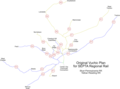
Article(s): en:SEPTA Regional Rail
- Request
- Hi! Please vectorize these two raster map files. Thank you! --OrdinaryScarlett (talk) 11:46, 3 March 2025 (UTC)
- Graphist opinion(s)